

Urban Roadway Construction with Integrated Sanitary and Storm Sewer Infrastructure - Construction Surveying
Urban Roadway Addition with Integrated Sanitary and Storm Sewer Infrastructure – Construction Surveying
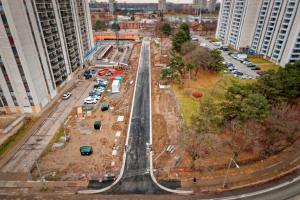
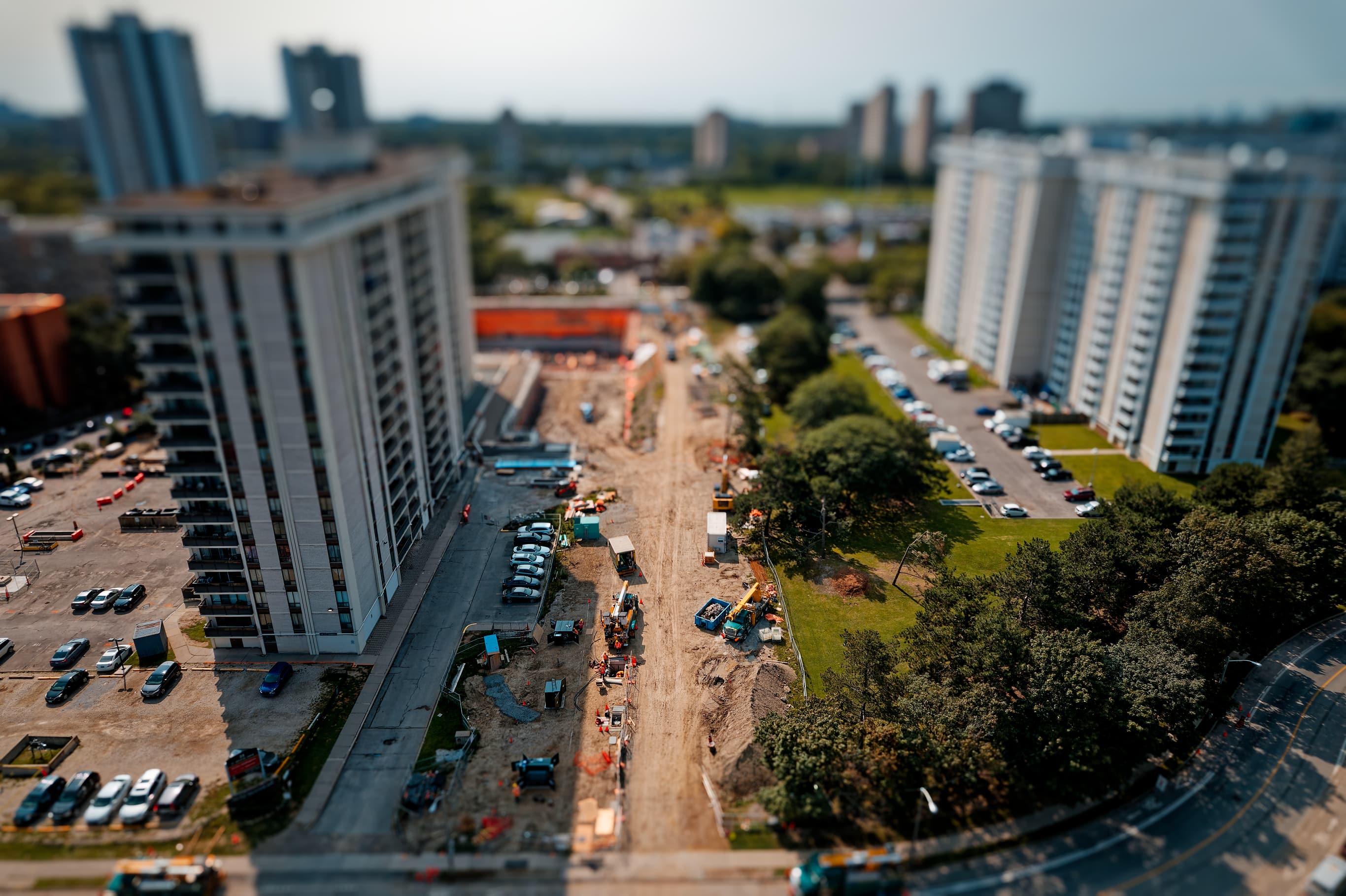
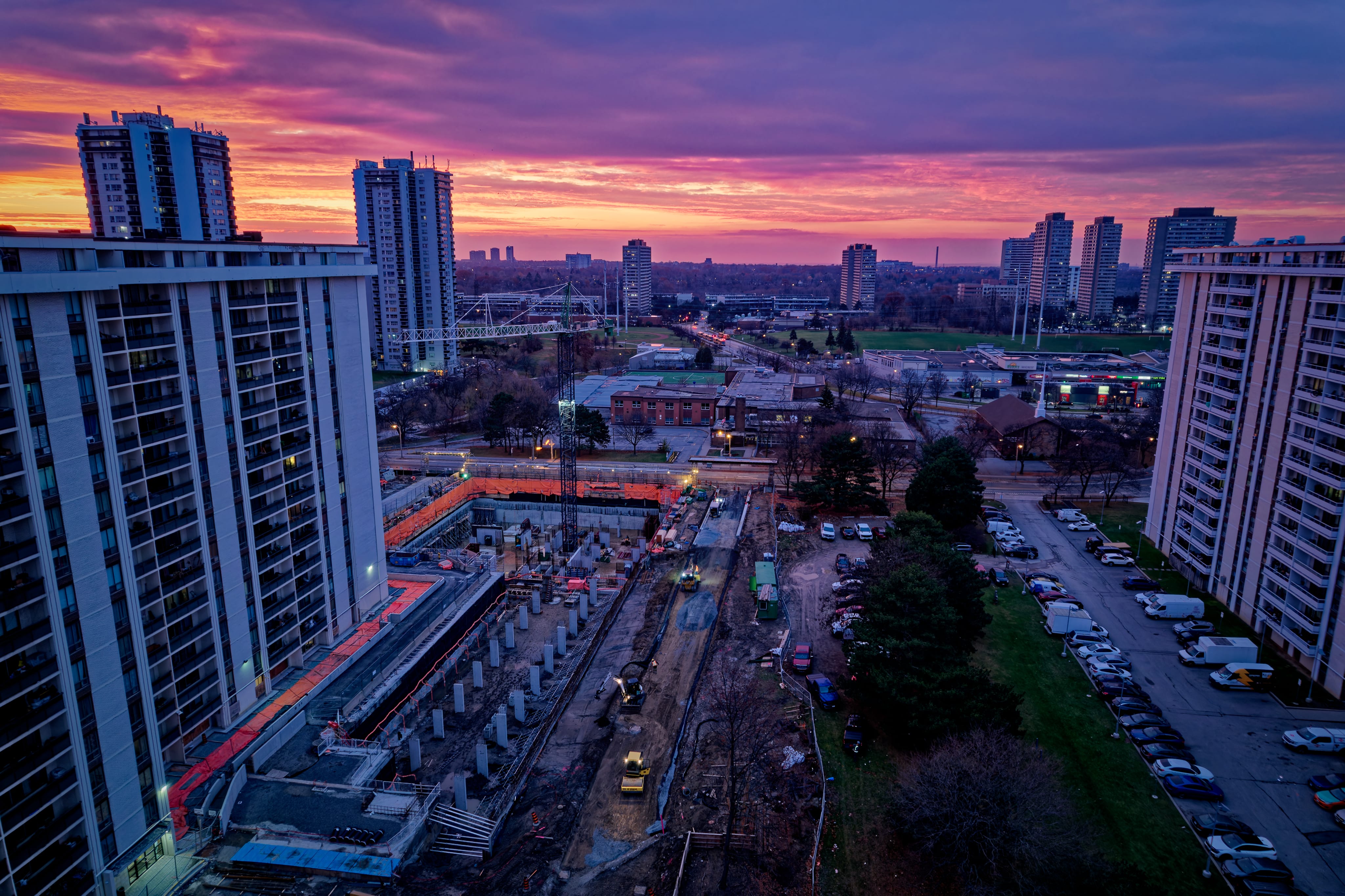
As part of ongoing municipal infrastructure improvements, Stratus Geomatics provided full surveying services for the construction of a new roadway segment within a constrained urban corridor for high rise buildings. The project required high-precision survey control, complex utility coordination, and detailed construction layout for both transportation and underground utility components.
Project Scope
The work involved establishing control and providing construction surveying support for
•Roadway alignment and grading
•Sanitary sewer main installation and lateral connections
•Storm sewer conveyance system, including manholes, catch basins, and downstream tie-ins
•Surface improvements, including curb & gutter, sidewalk, and pavement structure
Survey Control & Data Acquisition
•Established primary and secondary control tied to local geodetic benchmarks, using GNSS and total station networks.
•Performed high-density topographic data collection of existing utilities, corridors, and surrounding structures.
•Verified horizontal and vertical tolerances to meet municipal engineering standards (e.g., millimeter-level for utility invert sets).
Utility Investigation & Coordination
•Conducted comprehensive utility research and field verification using:
•Record drawings (as-built data)
•Electromagnetic locating
•Ground-penetrating radar where required
•Mapped existing sanitary, storm, water, gas, telecom, and electrical infrastructure to reduce conflict risk during excavation.
•Coordinated directly with utility owners for clearance requirements and relocation constraints.
Construction Layout Services
Our team provided precise staking for all civil works, including:
•Sanitary sewer mains: centerline offsets, manhole locations, rim elevations, invert elevations, and pipe slopes.
•Storm sewer systems: pipe alignments, structure locations, sump elevations, catch basin grids, and outlet connections.
•Roadway improvements: centerline, edge of pavement, subgrade elevations, curb & gutter line, sidewalk grades, and surface drainage features.
•Provided cut/fill calculations, slope stakes, and grade sheets for contractor use.
Quality Assurance & As-Built Documentation
•Verified installed pipe slopes and invert elevations to ensure compliance with approved design tolerances.
•Performed periodic QA field checks during installation to confirm alignment, grade, and structure positioning.
•Completed end-of-project as-built surveys, delivering:
•3D utility models
•Updated plan/profile sheets
•GIS-compatible data formats for municipal asset management
Project Challenges & Technical Solutions
•Dense Utility Congestion: Resolved conflicts by refining alignments using detailed survey data and coordinating with design engineers.
•Urban Access Constraints: Utilized robotic total stations and compact survey setups to maintain precision in narrow right-of-way environments.
•Elevation Control Sensitivity: Employed redundant checks and closed-loop leveling to maintain vertical accuracy throughout installation.
Project Media for 25 Saint Dennis Drive


Check out our many projects showcased on our Instagram page.