
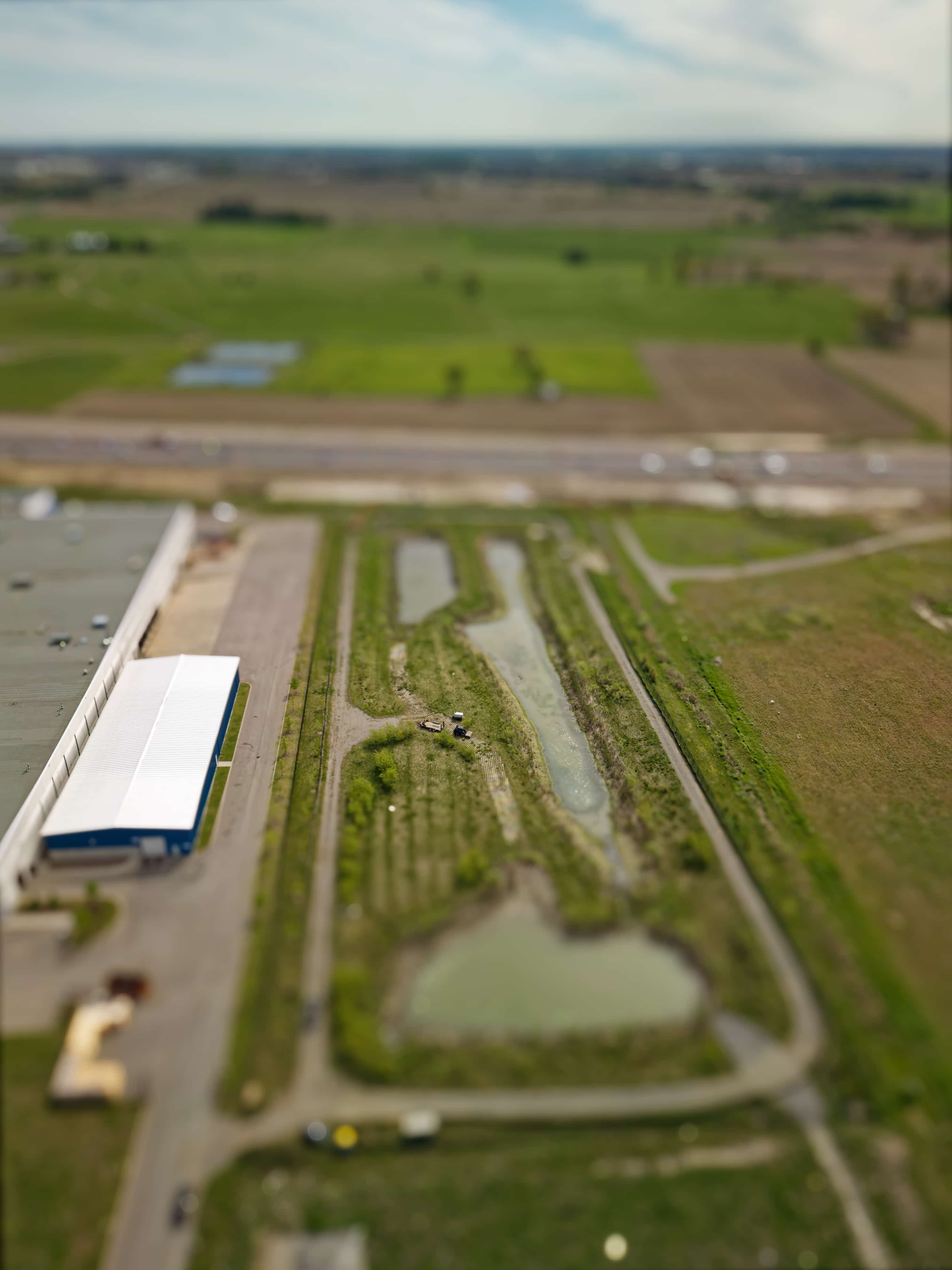
At Stratus Geomatics, we continue to support contractors and engineering teams with accurate and dependable survey data for critical municipal infrastructure. Our team recently completed a series of high-resolution topographic and LiDAR surveys for a contractor responsible for cleaning and restoring a stormwater management pond.
Project Overview
The objective of the project was to verify the existing sediment accumulation, support excavation planning, and ultimately confirm that the stormwater management pond meets the design storage volume after cleaning. To achieve this, multiple survey phases were completed under varying conditions.
Bathymetric Survey Phases & Methodology
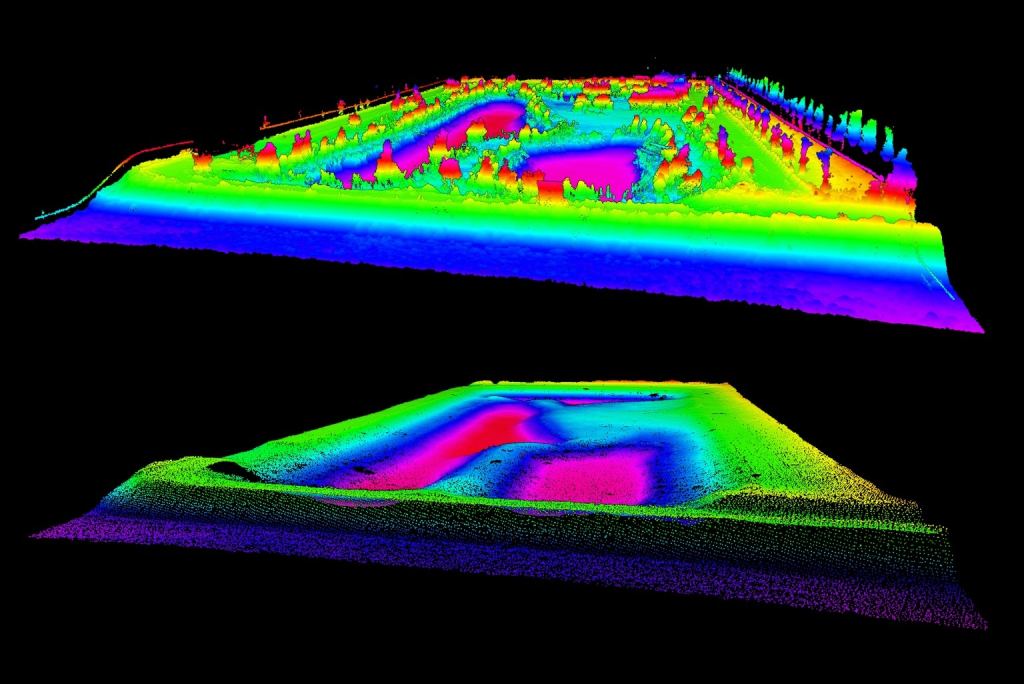
1. Pre-Cleaning LiDAR Survey (Drawdown Condition)
Before sediment removal began, the pond water level was drawn down to expose as much basin area as possible.
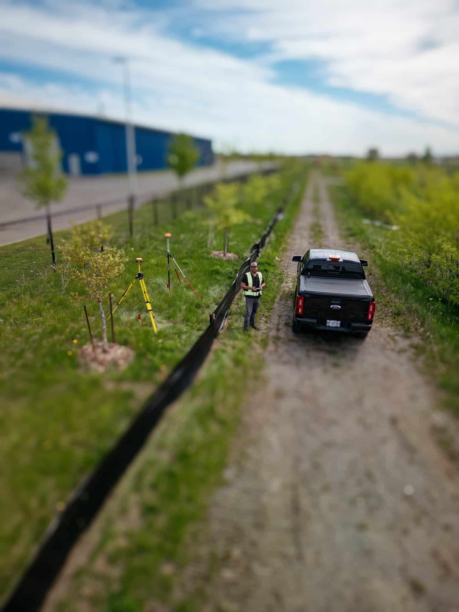
Our team completed a high-density terrestrial and drone-based LiDAR topographic survey, capturing:
•Basin geometry
•Existing sediment elevations
•Inlet/outlet structures
•Side slopes and embankment conditions
This dataset provided the contractor and engineers with reliable information to quantify sediment volumes and determine excavation limits.
2. Post-Cleaning Topographic Verification
Once cleaning and restoration activities were completed, our crew returned to conduct a follow-up topographic and LiDAR survey to:
•Verify final grading
•Measure the restored pond bottom
•Confirm slopes, outlet structure elevations, and design tie-ins
•Provide accurate as-built conditions for engineering analysis
Redundant control and precise elevation checks were used to ensure high accuracy, especially in low-lying and soft-surface areas.
Engineering Review & Capacity Confirmation
All survey datasets—pre- and post-cleaning—were delivered to the engineer of record, who used the information to:
•Analyze sediment removal effectiveness
•Compare existing grades against design contours
•Confirm the restored storage volume meets municipal stormwater requirements
Our data ensured the engineering team could validate compliance with design standards and confirm that the pond performs as intended for stormwater quantity and quality control.
Deliverables Provided
•High-resolution point clouds (LAS/LAZ)
•Georeferenced orthomosaic imagery
•Detailed topographic surface models (TINs/DEMs)
•Pre- and post-cleaning volume calculations
•As-built plans for municipal submission
Supporting Infrastructure Resiliency
Stormwater management ponds play an essential role in flood prevention, erosion control, and water quality treatment. By providing accurate survey data throughout all stages of rehabilitation, Stratus Geomatics helps ensure these systems continue to function at their designed capacity and support long-term municipal resiliency.
Bathymetric Survey & LiDAR Mapping Media Gallery


Check out our many projects showcased on our Instagram page.