Elevate Your Construction Project with LiDAR Precision! 1 - Day Results on Complex Terrain
The project site presented significant challenges for construction due to an overabundance of excess fill and irregularly arranged piles; however, we solved this with a LiDAR scan.
Our client required a precise quantification of every cubic centimetre of material present on site before any work activities commenced.
To effectively address the complex and unique requirements of the new condominium development situated at the intersection of Jane Street and Highway 7 in Vaughan, Ontario, our dedicated team has implemented a careful, strategic approach to surveying. By integrating both LiDAR (Light Detection and Ranging) and GPS topographic surveying techniques, we ensured the creation of a comprehensive, detailed, and highly accurate map of all existing utilities and infrastructure well in advance of the commencement of our client’s construction activities.
At the outset, the project’s scope seemed straightforward: conduct a standard GPS as-built survey, with a primary focus on the area surrounding a planned parking lot. Early expectations were that GPS technology alone would provide sufficient data for the client’s needs. However, upon conducting a meticulous, hands-on inspection of the development site, we quickly uncovered a host of unforeseen complexities. Chief among these were extensive deposits of construction materials—namely, segregated gravel and topsoil—that had been deposited and accumulated over time in a somewhat disorganized and uneven manner. This haphazard distribution of materials drastically altered the site’s surface profile and presented a significant challenge for surface modeling, as it threatened the reliability and accuracy of any GPS-derived results.
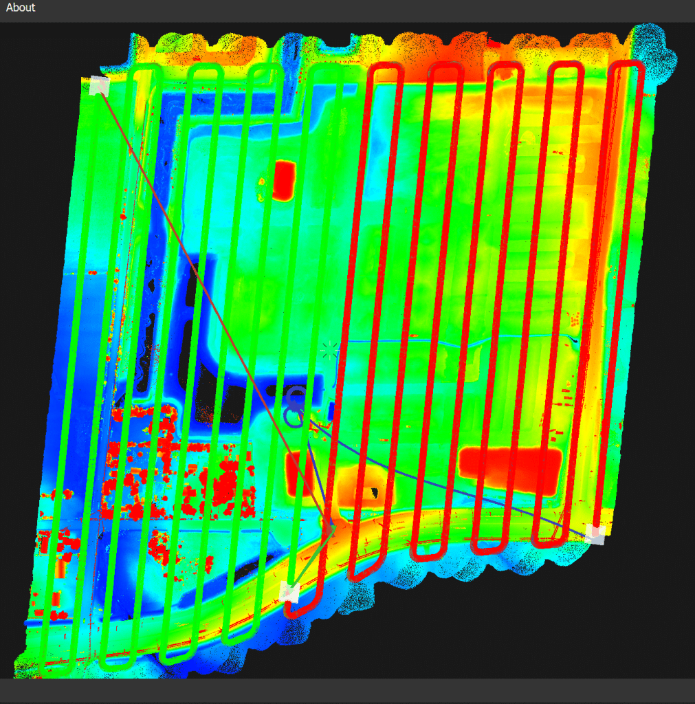
Recognizing the limitations inherent in relying solely on GPS in environments marked by extensive and uneven material deposits, our team made a well-informed recommendation: to expand the survey scope by incorporating advanced LiDAR technology. LiDAR is an innovative remote sensing technique that utilizes laser pulses to measure variable distances to the earth, generating highly accurate and high-resolution three-dimensional representations of surface features and man-made structures. By deploying LiDAR across the site, we were able not only to capture the subtle variations in the landscape, but also to obtain vital data on the composition and distribution of materials, utilities, and existing infrastructural elements.
The integration of LiDAR into our workflow delivered significant benefits to both the surveying process and the ultimate project outcome. The data captured through LiDAR scanning enabled us to generate precise digital terrain models (DTMs) and digital surface models (DSMs), capturing the nuances of the current landscape with clarity unmatched by traditional methods. This comprehensive dataset empowered our client to make informed, data-driven decisions at every stage of their project, from planning and design through execution and post-construction verification.
Our team’s proficiency in leveraging cutting-edge tools and their capability to adapt the survey scope reflect our depth of knowledge in the application of advanced geomatics. By merging traditional GPS surveying with state-of-the-art LiDAR scanning, we were able to overcome site-specific challenges and supply our client with a superior quality deliverable, tailored to their exact specifications and construction timeline.
When you choose Stratus Aerial Geomatics for your LiDAR survey needs, you gain access to a host of distinct advantages. Our organization is dedicated to embracing the latest technological advancements, ensuring that every project benefits from the industry’s most effective tools and methodologies. Our commitment to ongoing professional development ensures that our personnel stay up-to-date with evolving practices and innovations, allowing us to maintain a standard of accuracy, efficiency, and safety that is second to none. The high-resolution data we capture is meticulously processed and tailored to address the unique objectives of each client and project, resulting in faster turnaround times and improved project outcomes.
Exceptional aerial surveying does not simply result from access to leading technology; rather, it is rooted in a deep understanding of our clients’ specific goals and concerns. Our friendly, approachable, and highly skilled team works closely with clients at every stage—from planning and data collection through to analysis and final reporting—ensuring that all relevant details are addressed and that no aspect of the project is overlooked.
Partnering with Stratus Aerial Geomatics means you are not merely contracting a surveying service, but are engaging a passionate, dedicated team genuinely invested in delivering excellence. We strive to foster strong client relationships, built on trust, open communication, and a shared drive for success. Together, we can transform challenging surveying requirements into opportunities for remarkable outcomes.
We invite you to experience firsthand the Stratus Aerial Geomatics difference. Let us help you realize the full potential of your development projects with precision, reliability, and innovation at every step.

Preparing for a LiDAR scan in Vaughan

Excavation Efficiency: Using Lidar and Drones in 2 Steps
LiDAR topographic survey, just in time before site servicing and excavation works.
When it comes to accurate data that makes a difference, Stratus Geomatics delivers. A perfect DTM surface makes the difference for our sewer and watermain client, ensuring they know exactly how much material is on site and where to move it.
After a careful, detailed LiDAR drone flight, we meticulously extracted every trace of vegetation and removed water anomalies, revealing a pristine point cloud that vividly captures the ground surface contours. Following this, we crafted a sophisticated CAD-compatible surface in Trimble Business Center, empowering our client’s geomatics department to assess the volume of surplus soil accurately and ensuring a smooth, efficient project execution.
Utilizing a LiDAR technology provider like Stratus Geomatics for pre-excavation topographic surveys significantly reduces costs for construction companies involved in earthworks, sewer, and water main installations. By providing precise, high-resolution data, LiDAR enhances project planning and execution, minimizing the risk of costly errors and delays. This technology streamlines GPS integration, ensuring accurate mapping of existing infrastructure —a crucial factor for efficient earthworks operations and installations.
For construction companies, adopting a LiDAR service provider for topographic surveys improves resource allocation and reduces unforeseen expenses. Accurate data helps in identifying potential issues before work begins, leading to smoother operations in sewer and water main projects. By investing in LiDAR technology, businesses can improve their competitive edge, enhance project outcomes, and ultimately save money in the long run.
Choosing Stratus Aerial Geomatics as your go-to drone service provider for LiDAR surveys comes with a bunch of fantastic benefits that we can’t wait to share with you! We’re all about embracing the latest technology, and our commitment to staying ahead of the game means you’ll receive top-notch service that truly stands out. One of the things that sets us apart is our dedication to training and development. We know that drone tech and LiDAR methods are always changing, so our team is constantly learning and sharpening their skills. By keeping up with the newest techniques and software updates, we ensure your surveys are conducted with the best tools available.
We also take pride in our cutting-edge equipment, which allows us to gather aerial data that’s not just accurate, but also detailed and precise. With our latest drone platforms and lidar sensors, we can capture high-resolution data that meets the needs of various fields, from construction to environmental assessments. This means faster data collection and quicker turnaround times for you! At Stratus Aerial Geomatics, we believe that getting the best aerial survey goes beyond just technology; it’s about understanding your unique project needs and paying attention to all the little details.
Our friendly, experienced team works closely with you to make sure we’re capturing the data that really matters for your project. So, when you partner with us for your lidar survey needs, you’re not just getting a service provider; you’re gaining a dedicated team that’s passionate about delivering great results.
Let’s work together to achieve amazing outcomes!