

Bathymetric Survey & LiDAR Mapping for Stormwater Management Pond Rehabilitation
Bathymetric Survey & LiDAR Mapping for Stormwater Management Pond Rehabilitation
Project Overview
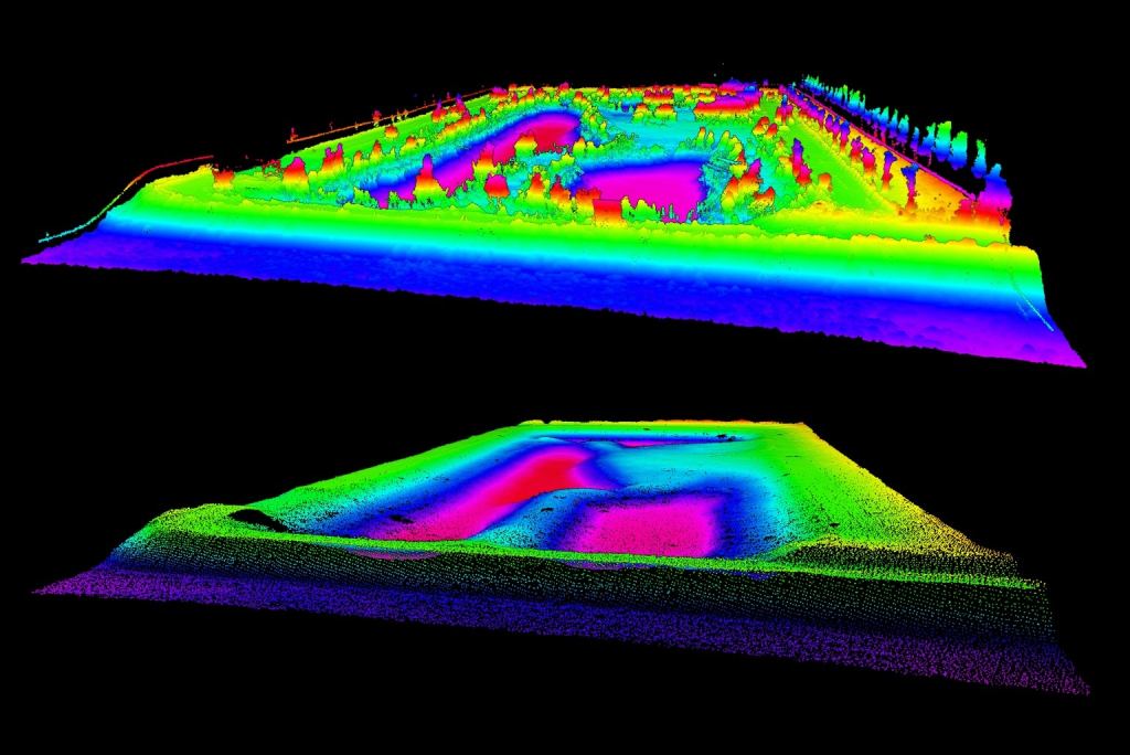
Bathymetric Survey Phases & Methodology
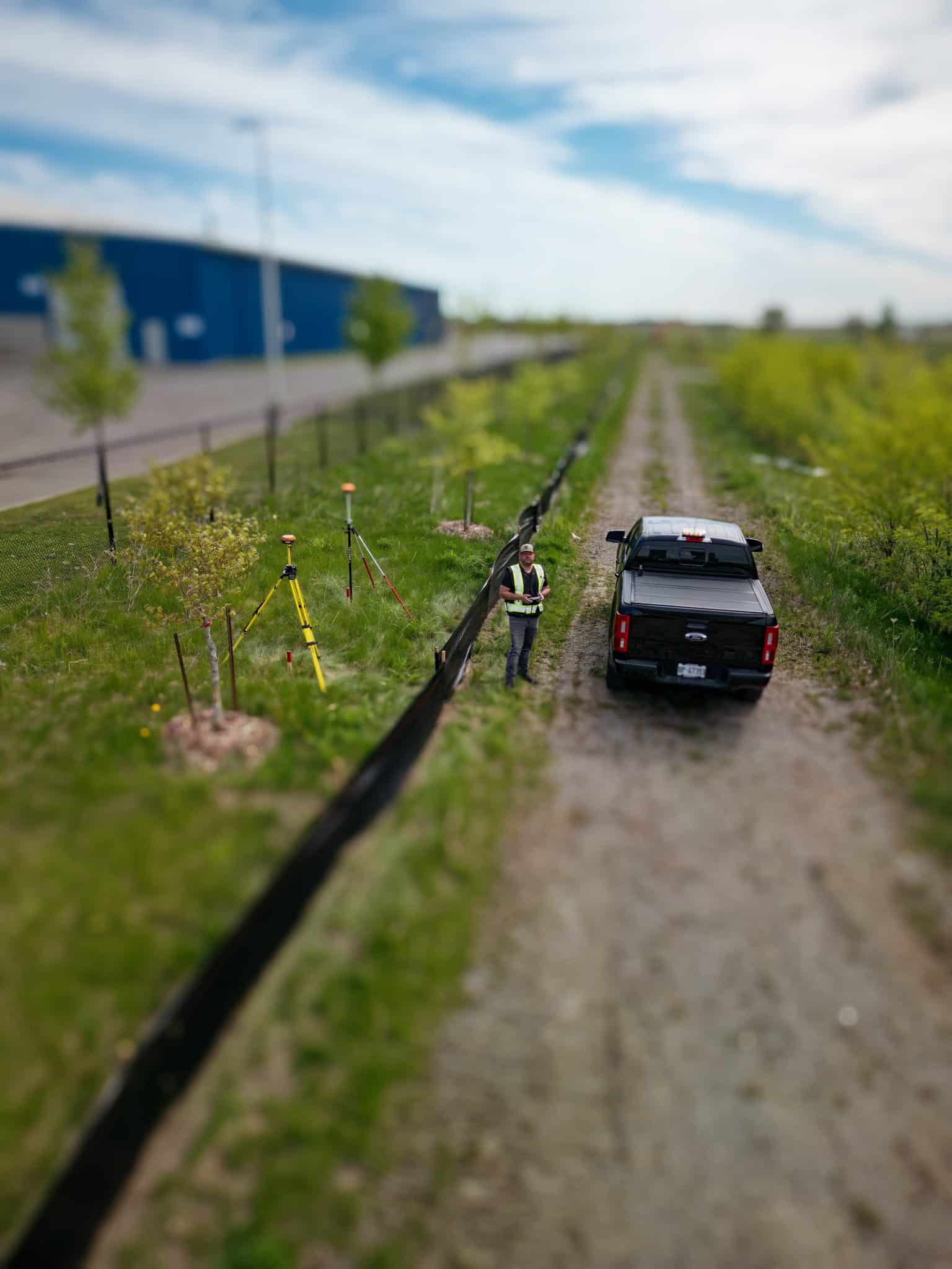
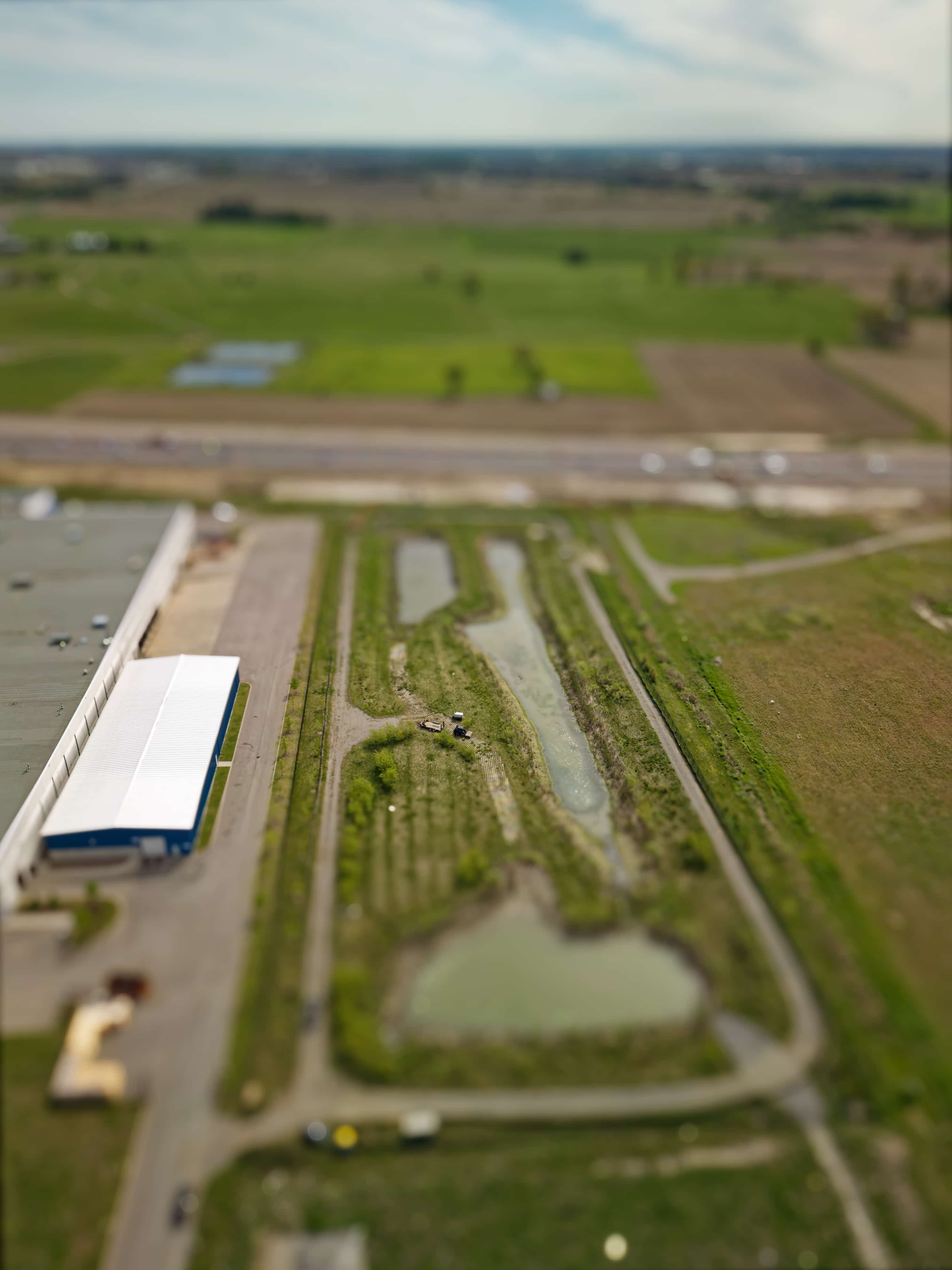
1. Pre-Cleaning LiDAR Survey (Drawdown Condition)
2. Post-Cleaning Topographic Verification
Engineering Review & Capacity Confirmation
All survey datasets—pre- and post-cleaning—were delivered to the engineer of record, who used the information to:
Deliverables Provided
Supporting Infrastructure Resiliency
Bathymetric Survey & LiDAR Mapping Media Gallery


Check out our many projects showcased on our Instagram page.

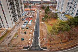
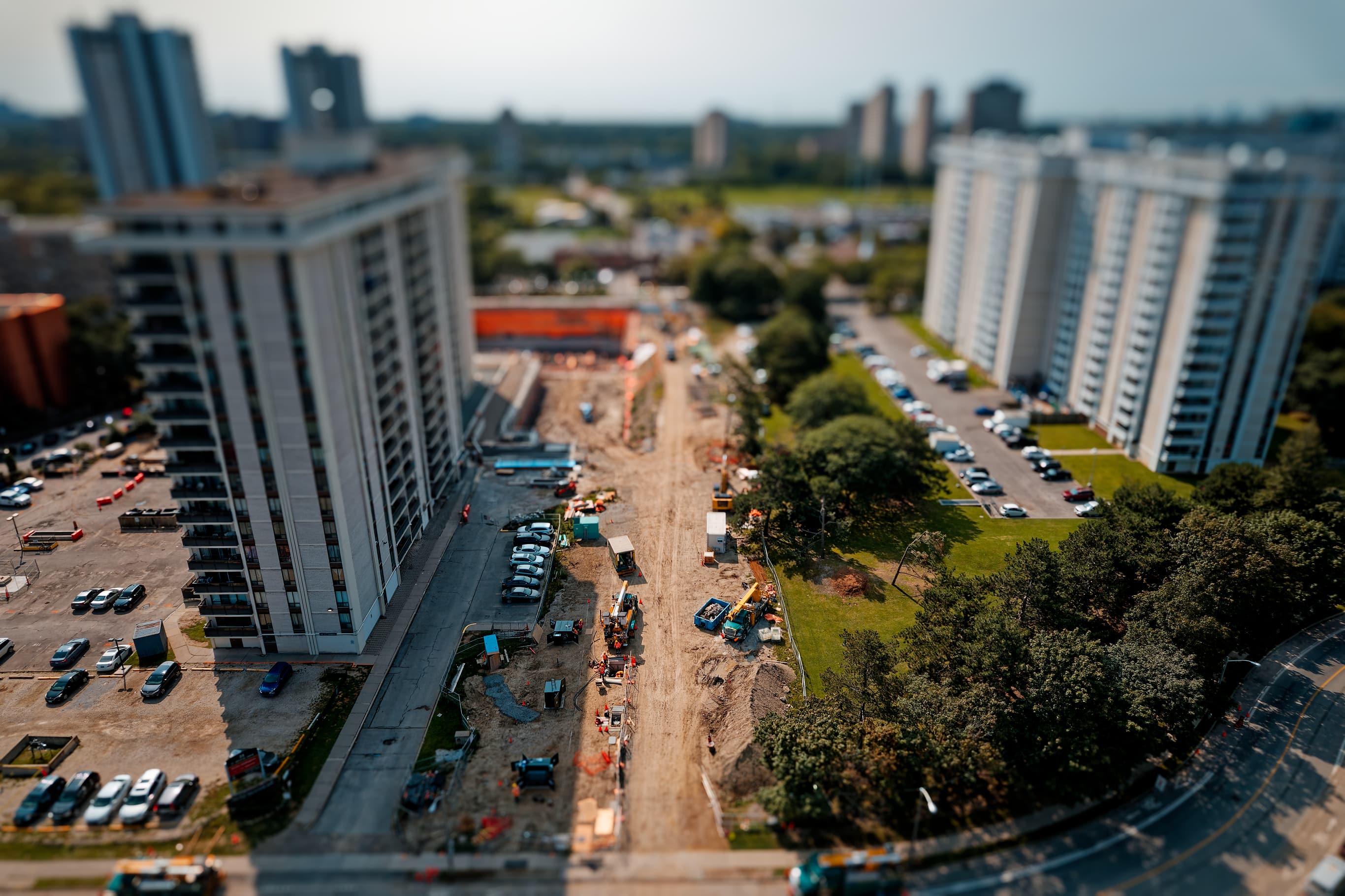
Urban Roadway Construction with Integrated Sanitary and Storm Sewer Infrastructure - Construction Surveying
Urban Roadway Addition with Integrated Sanitary and Storm Sewer Infrastructure – Construction Surveying
Project Scope
The work involved establishing control and providing construction surveying support for
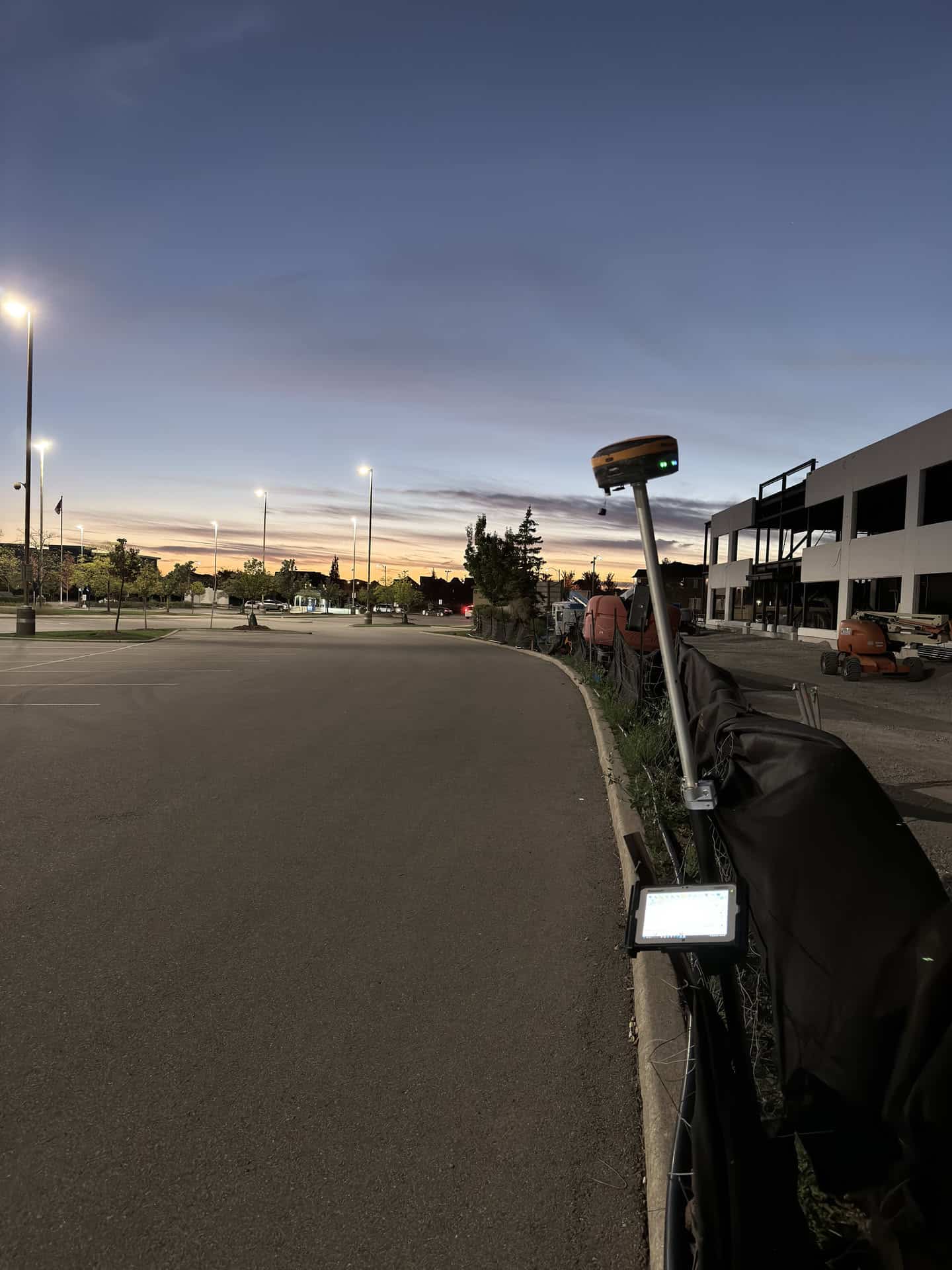
Survey Control & Data Acquisition
Utility Investigation & Coordination
Construction Layout Services
Quality Assurance & As-Built Documentation
Project Challenges & Technical Solutions
Project Media for 25 Saint Dennis Drive


Check out our many projects showcased on our Instagram page.
GPS Data Prep and Curb Layout
Introduction
The precision engineering field is continually evolving, with advancements in technology allowing for greater accuracy and efficiency in project execution. One such advancement is the integration of GPS data preparation into engineering processes. This case study delves into a specific project involving precision engineering through the meticulous preparation of GPS data, highlighting its significance, methodologies employed, and the outcomes achieved.
Accurate data is the backbone of any successful engineering project. The reliance on precise measurements and well-structured data ensures that designs are executed correctly, leading to improved safety, reduced costs, and enhanced project timelines. This article outlines the entire process, from file acquisition to the creation of 3D surfaces for machine control, illustrating how each step contributes to the accuracy and reliability of engineering projects.
File Acquisition and Initial Rectification
Obtained CAD File from an Engineering Firm
The first step in the GPS data preparation process involved acquiring a Computer-Aided Design (CAD) file from an established engineering firm. This file contained crucial design aspects that would guide the entire project. The CAD file typically includes detailed drawings and specifications required for the preparation of the site layout.
Upon receipt, the file underwent initial scrutiny to ensure compatibility with the GPS data processing software. This examination included checking the file format, layer management, and the presence of necessary attributes. If any discrepancies or missing elements were detected, the engineering firm was consulted for clarifications or revisions to the CAD file, ensuring the foundation for subsequent processes was robust.
Rectification Process Using Professional Land Surveyor's Control Points
Once the CAD file was confirmed to be in order, the next phase involved rectification. This process entailed using control points provided by a professional land surveyor to ensure the CAD models aligned accurately with real-world coordinates. Control points serve as reference markers that enhance the accuracy of spatial data inputs.
The rectification process included adjusting the CAD file to match the precise geospatial location defined by the control points. By employing a rigorous methodology, any potential errors in the initial data set were corrected, thus laying a strong groundwork for the upcoming data localization and quality assurance phases.
Data Loading and Localization
Loading Data into CAD
With the rectified CAD file ready, the next step involved loading additional site data into the CAD environment. This included importing GPS data captured during preliminary survey sessions. The integration of this data is crucial as it provides real-time positional information that aligns with the designed CAD model.
The loading process also required careful management of layers, ensuring that the GPS data did not interfere with the existing CAD layers. Each layer's functionality must be preserved to maintain clarity and usability. Once the data was successfully loaded, it was essential to verify that all components appeared correctly in the CAD workspace.
Utilizing GPS Base and Rover for Site Localization
The localization of data was achieved through the deployment of GPS base and rover systems, which provide real-time positioning capabilities. The base station, set at a known location, transmits data to the rover, which collects information from various points across the site.
This system allows for high-precision measurements and the ability to adjust any discrepancies in the data as they arise. The use of GPS technology significantly enhances the speed and accuracy of site localization, ensuring that all engineering components align with the project specifications outlined in the CAD drawings.
Quality Assurance through Check Shots
Checking All Check Shots Against the CAD
Quality assurance is paramount in engineering projects, necessitating a thorough validation of data against the CAD model. This phase involved executing check shots at various locations to compare actual measurements with the intended design. Each check shot provided a point of reference that helped assess the accuracy of the GPS data collected.
Ensuring Data Accuracy and Reliability
Data accuracy and reliability were further reinforced through the implementation of redundant checks and cross-referencing with alternative data sources. This multi-faceted approach meant that any potential errors were caught early, minimizing the risk of costly mistakes during later stages of the engineering process.
Additionally, documentation of all quality assurance efforts was maintained, providing a comprehensive audit trail that could be referenced throughout the project's lifecycle. This documentation not only serves as a record but also aids in future projects by showcasing the methodologies employed for ensuring data integrity.
Preparation of Line Work and Surfaces
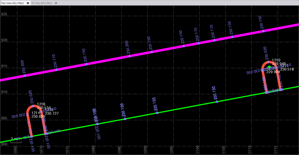
Elevating Line Work for Accurate Curb Layout
After the quality assurance phase, the next focus shifted towards the preparation of line work essential for curb layout. This involved elevating line work derived from the CAD file to establish precise elevations for curbs and other critical infrastructure elements.
Accurate line work is vital for ensuring proper drainage, accessibility, and aesthetics in urban planning. The engineering team utilized the rectified GPS data to create highly accurate line elevations that adhered strictly to the planned designs. This attention to detail is crucial for the successful implementation of infrastructure projects.
Creating Line Strings and Surfaces for GPS Data Prep
Following the elevation adjustments, the team proceeded to create line strings and surfaces that would be used in the GPS data preparation. Line strings are sequences of points that define specific paths or boundaries, while surfaces represent the terrain and contours of the project area.
These elements were meticulously crafted to ensure they corresponded accurately with the overall project specifications. The integration of line strings and surfaces into the GPS data preparation not only enhanced the operational efficiency of machinery on-site but also facilitated the future stages of construction planning.
3D Surface Creation for Machine Control
Developing a 3D Surface for Machine Control File
One of the final steps in the GPS data preparation process involved developing a 3D surface that would serve as a machine control file. This surface is critical for guiding heavy machinery during excavation, grading, and other construction activities.
The 3D surface was generated based on the compiled line work and surface data, ensuring that all aspects of the project were represented in three dimensions. This development not only optimized the machinery's performance but also significantly reduced the potential for human error during operation.
Benefits of 3D Surface in Engineering Projects
The implementation of a 3D surface in engineering projects offers several benefits, including enhanced visualization, improved coordination, and increased precision in construction. By allowing operators to visualize the project in three dimensions, the likelihood of miscommunication and mistakes diminishes substantially.
Moreover, the integration of 3D surface models into machine control systems provides real-time feedback, allowing for immediate adjustments based on actual site conditions. This adaptability is crucial in achieving project goals efficiently and effectively.
Conclusion
Summary of Achievements
This case study illustrates the meticulous process of GPS data preparation in precision engineering, highlighting the importance of accurate data acquisition, rigorous quality assurance, and the creation of necessary models for successful project execution. Each step, from initial file rectification to the development of machine control files, plays a vital role in ensuring that engineering projects are completed on time and within budget while meeting all technical specifications.

Future Implications for Engineering and Land Surveying
The integration of advanced technologies such as GPS data preparation will undoubtedly shape the future landscape of engineering and land surveying. As these methods become more refined and widely adopted, they will enhance project accuracy, reduce costs, and streamline processes across the industry. The continuous evolution of technology promises a future where precision engineering becomes even more efficient and effective, paving the way for innovative infrastructure solutions.
FAQs
What is GPS data preparation in engineering?
GPS data preparation in engineering refers to the process of collecting, rectifying, and utilizing GPS data to ensure that engineering designs are accurately executed on-site. It encompasses various steps, including data acquisition, localization, quality assurance, and the creation of control files for machinery.
How does GPS improve engineering accuracy?
GPS improves engineering accuracy by providing high-precision location data that can be integrated into design models. This real-time positional information allows engineers and operators to align construction activities with exact specifications, reducing risks of errors and misalignments.
What are the benefits of using 3D surfaces in construction?
Using 3D surfaces in construction offers numerous benefits, including enhanced visualization of the project, improved coordination among teams, and increased precision in guiding machinery. This approach minimizes human error and optimizes the overall construction process.
Why is quality assurance important in GPS data preparation?
Quality assurance is crucial in GPS data preparation as it ensures the accuracy and reliability of the data used throughout the engineering process. By verifying measurements and conducting checks, the likelihood of costly mistakes is significantly reduced.
What role do control points play in the rectification process?
Control points are reference markers used in the rectification process to align CAD models with real-world coordinates. These points enhance the accuracy of spatial data inputs and provide a framework for verifying the integrity of engineering designs.
Check out our many projects showcased on our Instagram page.